In the fast-changing scene of urban development, demand for better, more effective, and environmentally friendly transport networks has grown historically significant. Economic development and social integration depend largely on transportation infrastructure development, that is, highways, railroads, bridges, airports, and ports. The planning and control of this infrastructure must change as population mobility increases and urban areas expand. Geographic Information Systems (GIS) are among the most potent instruments facilitating this change.
Understanding the Role of GIS in Transport Infrastructure Development and Its Core Capabilities
GIS fundamentally combines attribute data, such as traffic counts, road conditions, and environmental statistics, with spatial data such as location, topography, and land use. This multi-layered data strategy lets experts find connections, trends, and patterns that conventional approaches would find challenging to pinpoint.
GIS can address important issues, including:
- Where should a new road or rail line ideally run?
- Traffic jams affect which areas most?
- How might a new bridge impact close residential areas or local ecosystems?
Key Applications of GIS in Transport Infrastructure Development
Efficient Planning and Route Optimization
GIS is mainly used during the planning and design stage of transport infrastructure. GIS aids in determining the most appropriate routes and sites for new projects by examining terrain, population density, land use, and current transport networks. Planners may minimize land acquisition and environmental damage, evaluate building feasibility, and imagine several route possibilities.
For instance, extensive use of GIS in India’s planning of the Delhi Metro helped designers to maximize routes, thereby reducing displacement and environmental damage.
Traffic Flow and Mobility Analysis
Analyzing present and expected traffic trends depends much on GIS. GIS can assist in forecasting congestion spots, assessing current road performance, and designing future extensions by combining real-time data from sensors, GPS devices, and mobile apps. This helps to produce forecasts that are more precise and guides the building of infrastructure matching long-term mobility objectives.
GIS-integrated traffic management systems help cities like Singapore and Los Angeles to maximize signal timing and lower congestion.
Environmental and Social Impact Assessments
Thorough material and public impact studies are a tenable foundation. GIS gives the means essential to cover referring to practices or policies that do not negatively affect the environment, items like wetlands, being residences, and air value zones on conveyance plans. It also allows for the possibility of socio-financial aspects, including approaches to public comforts, loud noises, and the risk of dislocation.
This all-encompassing outlook guarantees that projects trail rules and advance tenable happenings.
Asset and Maintenance Management
GIS is essential for asset management and the maintenance of late infrastructure. GIS authorizes instrumentalities to sketch and listen to the United States of America’s transportation foundation, including bridges, tunnels, and roads. This dossier aids in lifecycle administration, cost predicting, and deterrent perpetuation preparation.
Highways England uses GIS in the UK to manage allure far-reaching road networks and to efficiently monitor advantageous environments.
Disaster Management and Resilience Planning
GIS helps conveyance planners spot domains vulnerable to natural disasters, including inundation, earthquakes, and landslides. It helps to plan crisis removal routes and to design a foundation smart to oppose specific events. GIS offers live maps of all disasters that support traffic rerouting and relaxation movements.
GIS was crucial in organizing emergency transportation services in the impacted regions during Hurricane Katrina, for instance.
Public Engagement and Transparency
Sharing interactive GIS maps and dashboards with the public helps to seek comments and display openness. Citizens can see suggested initiatives, grasp their effects, and help to shape the plan. This fosters more inclusive decision-making by establishing local trust.
Smart cities like Amsterdam and Barcelona have involved residents in urban transport planning using GIS-based tools.
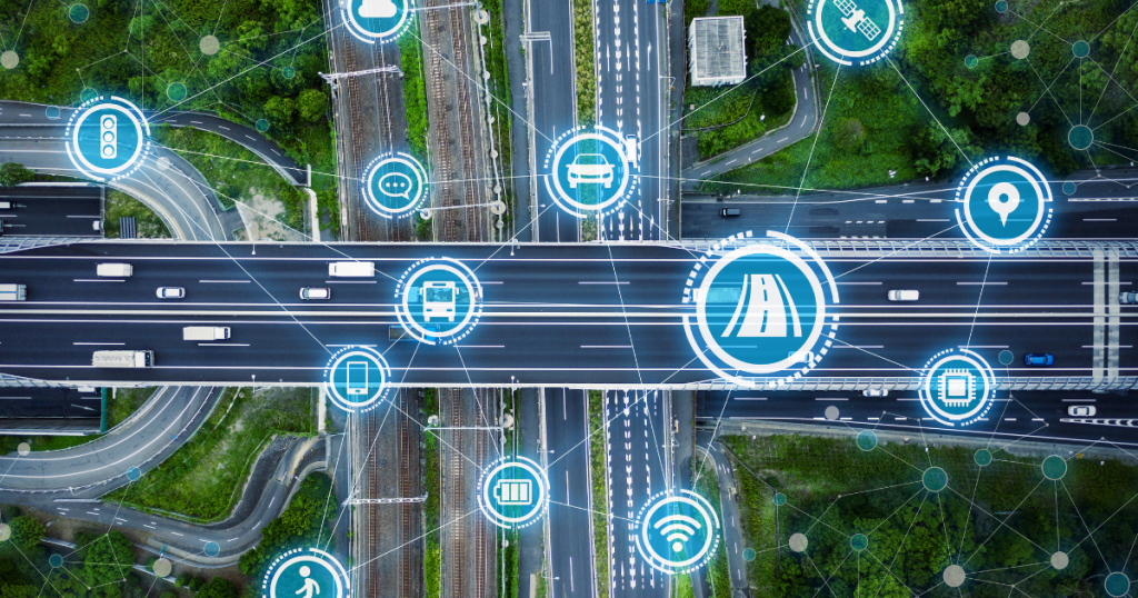
Integration with Smart Transportation Systems
Smart technologies, including IoT (Internet of Things), AI, and machine learning, are progressively combining with modern transportation facilities. These smart systems’ backbone is GIS. It aids in the schedule optimization of public transportation, management of autonomous vehicles, and real-time monitoring of traffic situations.
GIS will remain fundamental in allowing adaptive and linked transport systems as smart mobility technologies proliferate.

Challenges and Considerations
Although GIS offers great advantages, its application presents some difficulties:
- Initial setup costs and training demands are both great
- Data accuracy and interoperability issues
- Real-time tracking raises issues of privacy
- Resistance to transformation in conventional systems
Overcoming these obstacles calls for deliberate investment, capacity building, and excellent stakeholder coordination.
Future Developments: GIS and the Next Generation of Transport
Transportation will depend on data, systems, and modes integrated in the future. By allowing effortless coordination of road, rail, air, and sea connections, GIS will be essential to this convergence. Further improving the capacity to design better cities and sustainable mobility systems will be 3D GIS, cloud-based GIS, and AI-driven predictive analytics.
Conclusion
GIS in Transport Infrastructure Development is a strategic asset in the creation of transportation infrastructure; it is not an extra tool. From research and planning to execution and monitoring, GIS empowers stakeholders with spatial intelligence to design safer, more effective, and more environmentally friendly transport networks.
The use of GIS will become increasingly vital as technology changes our movement and urban areas develop. Building transportation systems that satisfy today’s needs while getting ready for tomorrow’s demands depends on embracing their capabilities.